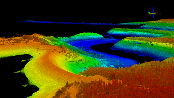
Lidar ground elevation data
- Get link
- X
- Other Apps
Lidar ground elevation data is a type of remote sensing data that is collected using a laser scanner. The laser scanner emits pulses of light that are reflected off of the ground surface. The time it takes for the pulses to return is used to calculate the distance between the laser scanner and the ground. This data can be used to create a three-dimensional model of the ground surface.
Lidar ground elevation data is used for a variety of applications, including:
- Mapping and surveying: Lidar data can be used to create detailed maps of the ground surface. This data can be used for a variety of purposes, such as planning infrastructure projects, monitoring environmental changes, and assessing the impact of natural disasters.
- Forestry: Lidar data can be used to map the extent of forests and to measure the height and volume of trees. This data can be used to manage forests and to assess the impact of climate change.
- Archaeology: Lidar data can be used to map the ground surface and to identify buried features, such as archaeological sites.
- Civil engineering: Lidar data can be used to map the ground surface and to identify potential hazards, such as landslides and sinkholes.
There are a number of different sources of lidar ground elevation data. Some of the most common sources include:
- Government agencies: Many government agencies, such as the U.S. Geological Survey (USGS), collect and distribute lidar ground elevation data.
- Private companies: There are a number of private companies that collect and distribute lidar ground elevation data.
- Open data portals: There are a number of open data portals that make lidar ground elevation data available for free.
The cost of lidar ground elevation data varies depending on the source, the resolution of the data, and the area that is covered. In general, lidar ground elevation data is more expensive than other types of remote sensing data, such as aerial photography.
Lidar ground elevation data is a valuable tool for a variety of applications. The data can be used to create detailed maps of the ground surface, to identify buried features, and to assess the impact of natural disasters. The cost of lidar ground elevation data varies depending on the source, the resolution of the data, and the area that is covered.
- Get link
- X
- Other Apps


Comments
Post a Comment